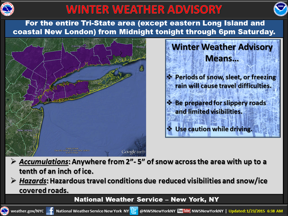
In addition to the Hazardous Weather Outlook issued earlier this week, the National Weather Service has issued a Winter Weather Advisory for Nassau County, and Western Suffolk County starting at midnight tonight. Two to five inches of snow is expected to accumulate tomorrow, and during that time, as well as up to 1/10th of an inch of ice, due to the sleet and freezing rain. The Advisory will stay in effect until 6 PM on Saturday.
Early Saturday morning, drivers are urged to take caution as there will be visibility of less than half a mile due to the snow, as well as slick road conditions from the sleet and freezing rain. There is also the potential for strong winds of 15 - 25 MPH with gusts of 30 MPH on Saturday during the day, and winds of 20 - 30 MPH with gusts of up to 40 MPH in the evening.
Also in effect 6 AM until 6 PM on Saturday is a Small Craft Advisory for the waters surrounding Long Island, due to the potential for high winds. There is also potential for minor coastal flooding during high tide during the day.
For the most up to date weather information, head over to the LongIsland.com Weather Center, where you can find the latest weather forecasts, advisories and more.
To get the latest traffic & road conditions before traveling, visit the LongIsland.com Traffic Center, and be sure to check out the live traffic feeds on our Traffic Cams Page.
[Sources: NWS.]
Photo via the NWS's Official Facebook Page.