
Weather Alert!
Weather |
LIRR |
Traffic |
Traffic Cams |
Weather News
| School Closings

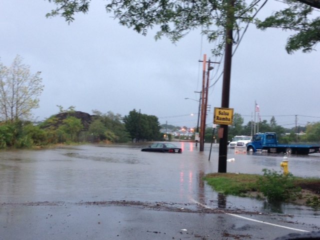
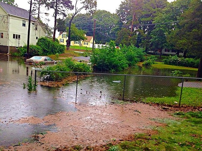
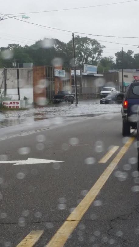
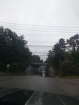
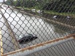
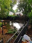
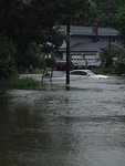
Floodageddon - August 13th flood photo from Bay Shore, NY.
Photo By : Amanda Bernocco
Photo By : Amanda Bernocco
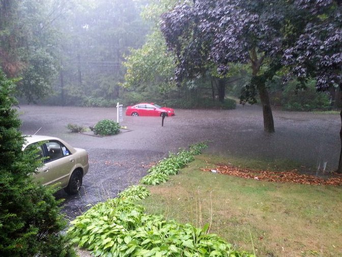
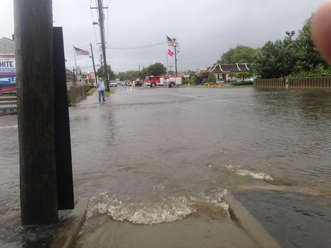
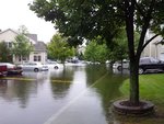
Floodageddon - August 13th flood photos.
Photo By : Kim Daino
Photo By : Kim Daino

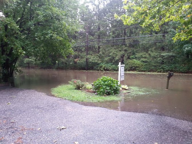
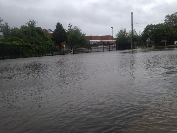
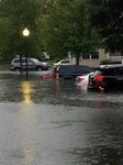
Floodageddon - August 13th flood photos.
Photo By : Sean Weber
Photo By : Sean Weber

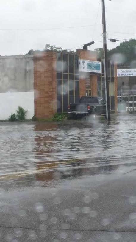
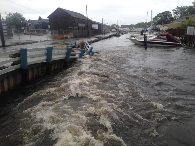
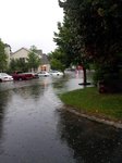
Floodageddon - August 13th flood photos.
Photo By : Sean Weber
Photo By : Sean Weber

Floodageddon - August 13th flood photo taken in Medford, NY.
Photo By : Robin P Lanteigne
Photo By : Robin P Lanteigne

Floodageddon - August 13th flood photo taken in Medford, NY.
Photo By : Robin P Lanteigne
Photo By : Robin P Lanteigne

Floodageddon - August 13th flood photo taken in Medford, NY.
Photo By : Robin P Lanteigne
Photo By : Robin P Lanteigne

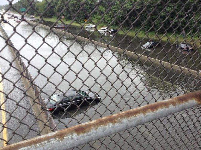
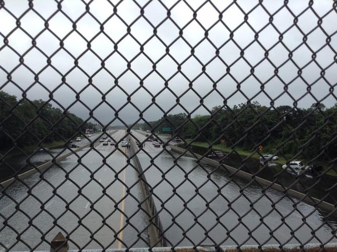
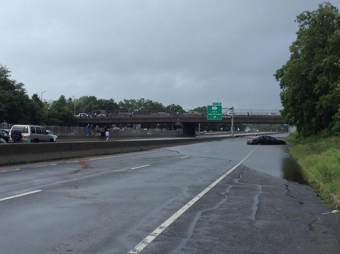
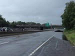
Floodageddon - August 13th flood photo from Sunrise Hwy Route 27A Exit 44.
Photo By : JJ Blanco
Photo By : JJ Blanco

Floodageddon - August 13th flood photo taken in Wyandanch, NY.
Photo By : Mallory Russell
Photo By : Mallory Russell
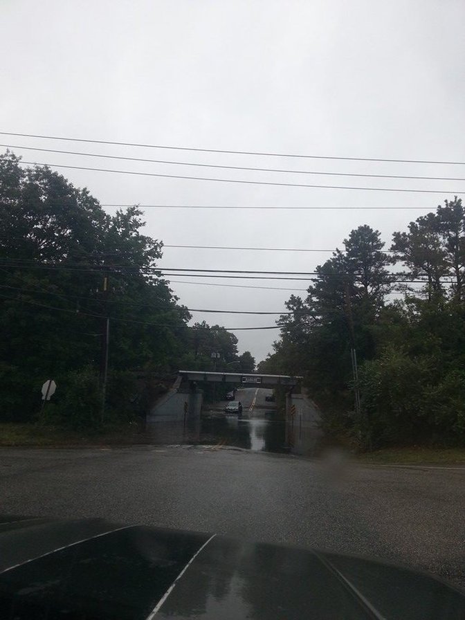
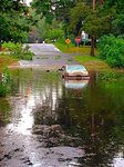
Floodageddon - August 13th flood photo taken over Sunrise Highway in Islip Terrace, NY.
Photo By : Emily Palomba
Photo By : Emily Palomba

Floodageddon - August 13th flood photo taken over Sunrise Highway in Islip Terrace, NY.
Photo By : Emily Palomba
Photo By : Emily Palomba
Floodageddon - August 13th flood photo taken over Sunrise Highway in Islip Terrace, NY.
Photo By : Emily Palomba
Photo By : Emily Palomba
Floodageddon - August 13th flood photo taken over Sunrise Highway in Islip Terrace, NY.
Photo By : Emily Palomba
Photo By : Emily Palomba
Floodageddon - August 13th flood photos.
Photo By : Juan Blanco
Photo By : Juan Blanco

Floodageddon - August 13th flood photos.
Photo By : Juan Blanco
Photo By : Juan Blanco

Floodageddon - August 13th flood photo taken at Lincoln Ave in Holbrook, NY.
Photo By : Robert T
Photo By : Robert T
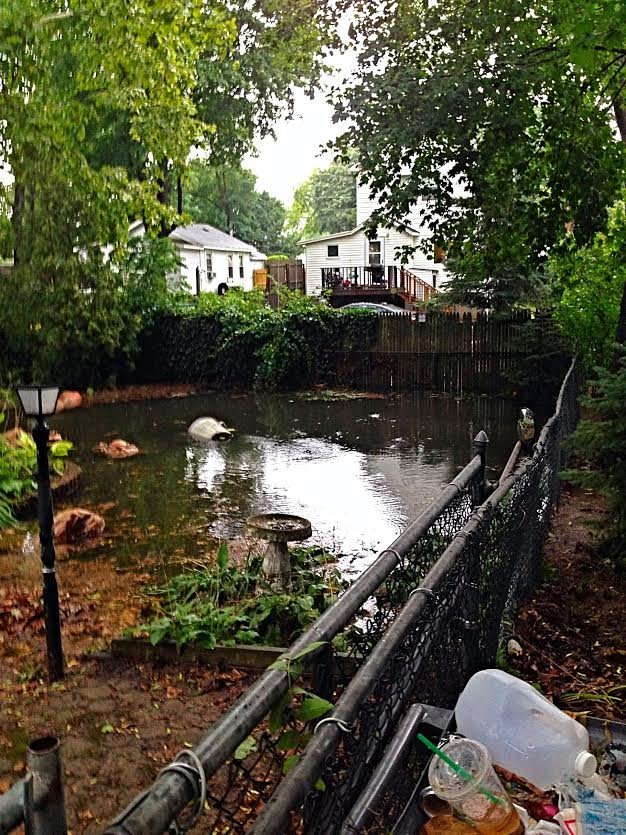
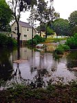
Floodageddon - August 13th flood photo taken at Wyona Avenue in Selden, NY.
Photo By : Margaret Ann Photography
Photo By : Margaret Ann Photography
Floodageddon - August 13th flood photo taken at Wyona Avenue in Selden, NY.
Photo By : Margaret Ann Photography
Photo By : Margaret Ann Photography
Floodageddon - August 13th flood photo taken at Wyona Avenue in Selden, NY.
Photo By : Margaret Ann Photography
Photo By : Margaret Ann Photography
Floodageddon - August 13th flood photo taken at Wyona Avenue in Selden, NY.
Photo By : Margaret Ann Photography
Photo By : Margaret Ann Photography

Floodageddon - August 13th flood photo taken at Wyona Avenue in Selden, NY.
Photo By : Margaret Ann Photography
Photo By : Margaret Ann Photography
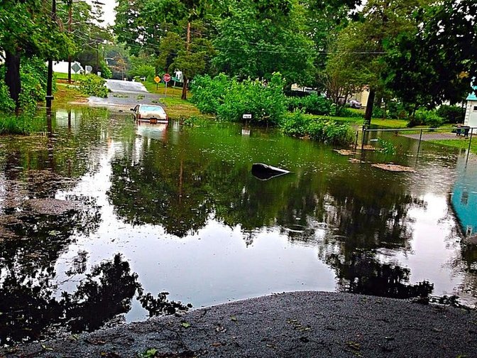
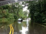
Flooding in Nesconscet early morning on August 13th, 2014.
Photo By : Lyndsay McCabe
Photo By : Lyndsay McCabe
Flooding in Nesconscet early morning on August 13th, 2014.
Photo By : Lyndsay McCabe
Photo By : Lyndsay McCabe

Flooding in Nesconscet early morning on August 13th, 2014.
Photo By : Lyndsay McCabe
Photo By : Lyndsay McCabe

Flooding in Nesconscet early morning on August 13th, 2014.
Photo By : Lyndsay McCabe
Photo By : Lyndsay McCabe
Floodageddon - August 13th flood photo taken at Union Avenue in Bay Shore, NY.
Photo By : Joe Galletta
Photo By : Joe Galletta
Floodageddon - August 13th flood photo taken at Union Avenue in Bay Shore, NY.
Photo By : Joe Galletta
Photo By : Joe Galletta
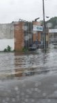
Floodageddon - August 13th's flood photos of Main Street, in Islip, NY.
Photo By : John Galletta
Photo By : John Galletta

Floodageddon - August 13th's flood photos.
Photo By : John Galletta
Photo By : John Galletta
Floodageddon - August 13th's flood photos.
Photo By : John Galletta
Photo By : John Galletta

Floodageddon - August 13th flood photo taken at Union Avenue in Bay Shore, NY.
Photo By : Joe Galletta
Photo By : Joe Galletta

Floodageddon - August 13th flood photo taken in Islip Terrace, NY.
Photo By : Heather Butterworth
Photo By : Heather Butterworth
Floodageddon - August 13th's flood photo of Main Street in Islip, NY.
Photo By : John Galletta
Photo By : John Galletta

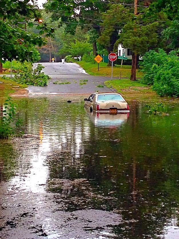
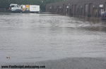
Floodageddon - August 13th flood photo taken at Morris Avenue in Holbrook, NY.
Photo By : Larry Buffa
Photo By : Larry Buffa


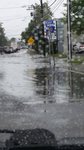


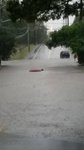
Floodageddon - August 13th's Flood
- Uploaded 9 years, 9 months ago
- 32112 times
The intense rainfall that began in the early hours of August 13th, 2014 has left Longer Islanders with major flooding, submerged vehicles, road blocks, and road closures.
Add your comment...
 Loading...
-
Winter Guide 2020
Winter Guide 2020 -
LI Votes 2013
Photos from the 2013 Elections -
Holiday Fun on Long Island
Photos of festive celebrations from across the Island. -
The Old Inlet, March 27th
At The Old Inlet, looking north. Shoaling is well underway -
Nearby NYC
Photos throughout New York City
- Things To Do
- Places To Go
- Events
- Museums
- Vineyards
- Restaurants
- Nightlife
- Beaches
Copyright © 1996-2017 LongIsland.com & Long Island Media, Inc. All rights reserved.