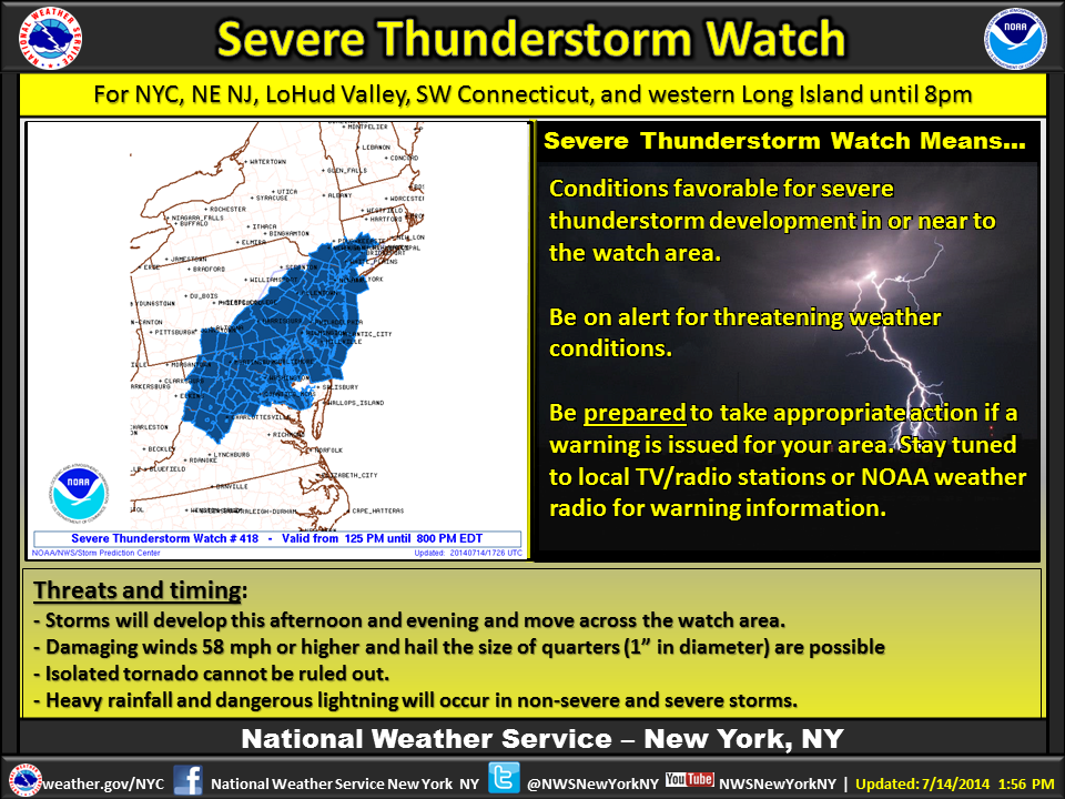
Update - July 14th, 1:30 PM - In addition to the Flash Flood Watch that is in effect for both Nassau & Suffolk County, the National Weather Service has issued a Severe Thunderstorm Watch for Nassau County. The Severe Thunderstorm Watch went into effect at 1:25 PM, and will stay in effect until 8 PM this evening. Please see the Severe Graphic below for a detailed map. The NWS warns locals to be prepared to take appropriate action, should the Thunderstorm Watch be escalated to a Warning. Be sure to check back regularly for updates,
A Flash Flood Watch has been issued, and will go into effect today at 12 PM, and stay in effect until 6 AM on Wednesday, July 16th in Nassau and Suffolk Counties. Locals and commuters should be advised alert will also be in effect in numerous other coastal regions of the tri-state area.
The National Weather Service is predicting multiple showers and thunderstorms to plague the area, followed by a cold front this afternoon. These conditions, combined with the current humidity will produce torrential downpours, amassing in 2 to 3 inches total rainfall.
The fast falling heavy rains may potentially create flash flooding in coastal areas, low lying areas, as well as roadways with poor drainage. Before you get ready to hit the road, be sure to visit LongIsland.com's Traffic Camera Center, where you can view local road conditions in real time.
Locals are advised to check back frequently for updates, and be prepared to take action, should the Flash Flood Watch be raised to a Flash Flood Warning. For the most up to date weather information, head over to the LongIsland.com Weather Center, where you can find the latest weather forecasts, advisories and more.
[Source: National Weather Service.]
Photo via the NWS NY's Official Facebook Page.