


Long Island, NY - March 20, 2018 - Long Islanders, we’re now officially getting our fourth – yes, fourth – nor'easter of March, and we’re only just past the halfway point of the month! And while the previous storms have been hit-or-miss in terms of the amount of precipitation left in their wake compared to their respective forecasts, the National Weather Service (NWS) is rather adamant in their predictions this time- this nor'easter will likely be a doozy...and on the second day of spring, no less!
The NWS has issued winter storm warnings for both Nassau and Suffolk, citing the probability that both Counties could see over a foot of snow in some areas, rendering travel nearly impossible Wednesday during the evening commute.
The storm is expected to take the form of rain beginning Tuesday evening that if forecast to transition into snow at approximately midnight; from there, the snowfall will increase in intensity, with the heaviest precipitation set to occur Wednesday afternoon with 1 to 2 inches of snow per hour possible, the NWS says. In addition, strong winds of 20-30 mph with gusts up to 45 mph are expected, which lead to power outages via downed trees, branches, and power lines. Snowfall is expected to last until early Thursday morning, according to reports.
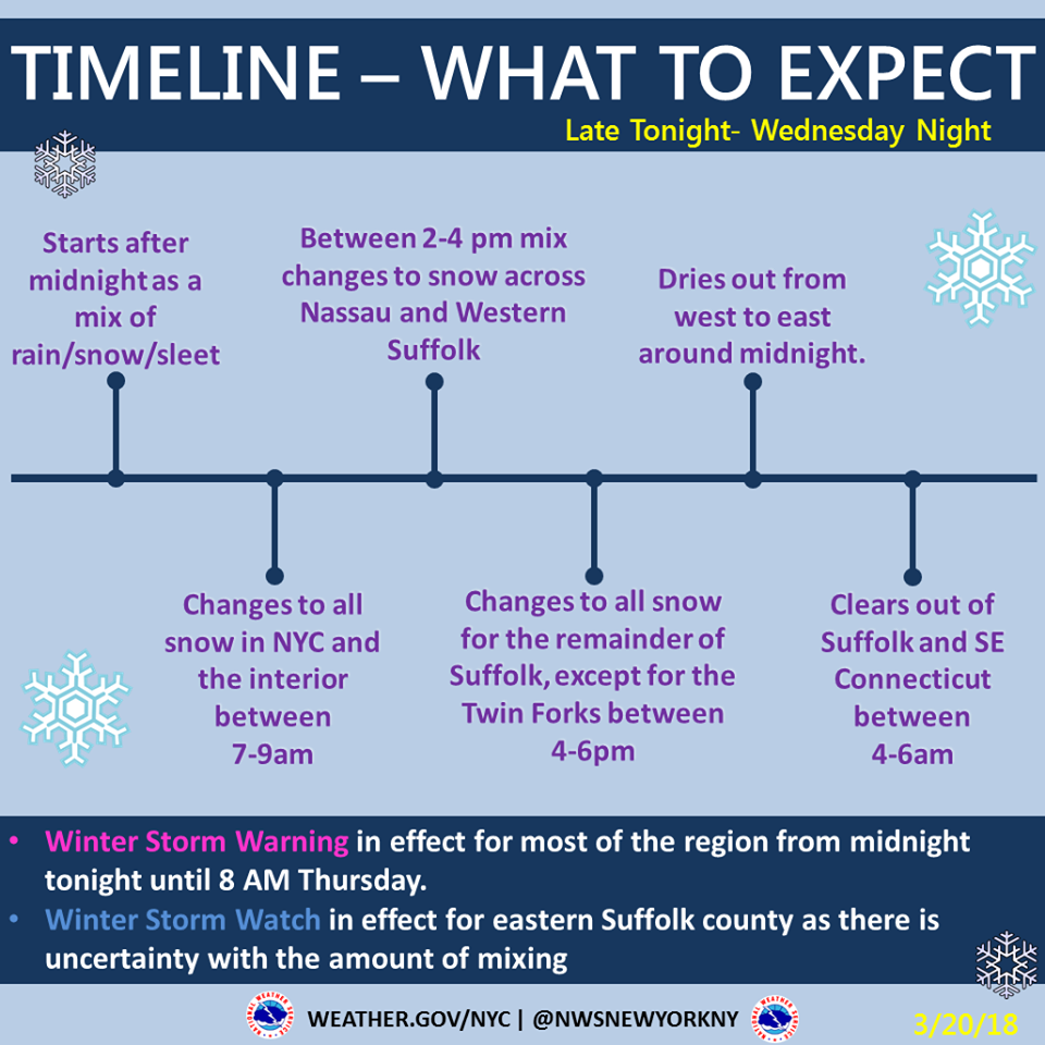
Photo Credit: National Weather Service
The NWS has issued the following storm warnings and/or watches:
- A winter storm warning will be in effect all day Wednesday until 8 a.m. Thursday for Nassau County, which will likely get hit the hardest. Total snow accumulations of 11 to 15 inches and light ice accumulations are expected.
- A winter storm warning will be in effect all day Wednesday until 8 a.m. Thursday for western Suffolk County. Total snow accumulations of 7 to 10 inches, with localized amounts up to 13 inches, and light ice accumulations are expected.
- A winter storm watch will be in effect all day Wednesday until 8 a.m. Thursday for eastern Suffolk. Total snow accumulations of 4 to 7 inches, with localized amounts up to 9 inches, and light ice accumulations are possible.
Residents are advised to prepare for possible power outages with blankets, flashlights, non-perishable food, water, and battery operated radios for storm and news updates.
PSEG Long Island issued a statement today, indicating their readiness to tackle the forth nor'easter of March, with vice president of Transmission and Distribution John O’Connell saying that PSEGLI has performed system checks on critical transmission and distribution equipment and logistics checks to ensure the availability of critical materials, fuel and other supplies.
“PSEG Long Island employees and contractors have worked tirelessly during the past three storms to successfully restore power to all customers who experienced outages from the severe weather,” he said. “Our first priority is always the safety of our customers and our employees. We are monitoring the approaching storm, our emergency preparedness plans are activated and in the event of outages, our crews are ready to begin once again to restore service safely and as quickly as conditions allow.”
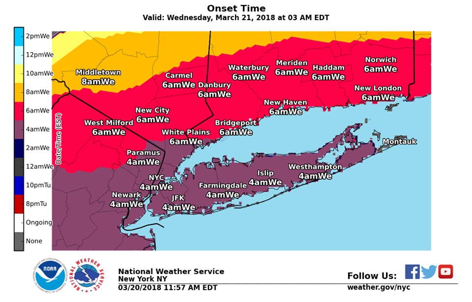
Photo Credit: National Weather Service
Be prepared and stay safe during extreme weather:
- To report and receive status updates on an outage Text OUT to PSEGLI (773454) or to report an outage online visit www.psegliny.com
- Follow PSEG Long Island on Facebook and Twitter to report an outage and to get updates before, during and after the storm
- Downed wires should always be considered “live.” Do not approach or drive over a downed line and do not touch anything contacting the wire. To report a downed wire call PSEG Long Island’s 24-hour Electric Service number: 1-800-490-0075
- Visit PSEG Long Island’s outage map to view outage information across Long Island and the Rockaways at https://outagemap.psegliny.com/
- Make sure everyone in the family is prepared and knows what to do if there is an emergency. Visit https://www.psegliny.com/page.cfm/Home/Safety to learn about safety tips, view YouTube safety videos, and more.
The full current NWS forecast for the storm (11793 Zip Code, Nassau County) is as follows:
- This Afternoon: A 20 percent chance of rain after 3pm. Cloudy, with a high near 38. Wind chill values between 30 and 35. East wind around 15 mph.
- Tonight: A chance of rain and snow before 1am, then snow and freezing rain likely between 1am and 4am, then snow, freezing rain, and sleet likely after 4am. Cloudy, with a low around 30. Wind chill values between 15 and 25. Blustery, with a northeast wind 20 to 24 mph, with gusts as high as 36 mph. Chance of precipitation is 60%. Little or no ice accumulation expected. New snow and sleet accumulation of less than a half inch possible.
- Wednesday: Snow, freezing rain, and sleet before noon, then rain, snow, and sleet between noon and 1pm, then snow after 1pm. The snow could be heavy at times. Some thunder is also possible. High near 34. Wind chill values between 15 and 20. Windy, with a northeast wind around 26 mph, with gusts as high as 40 mph. Chance of precipitation is 100%. Little or no ice accumulation expected. New snow and sleet accumulation of 3 to 7 inches possible.
- Wednesday Night: Snow, mainly before 1am. The snow could be heavy at times. Some thunder is also possible. Low around 31. Wind chill values between 20 and 25. Blustery, with a north wind around 24 mph, with gusts as high as 36 mph. Chance of precipitation is 80%. New snow accumulation of 3 to 7 inches possible.
- Thursday: A 30 percent chance of snow, mainly before 7am. Partly sunny, with a high near 42. Northwest wind around 17 mph.