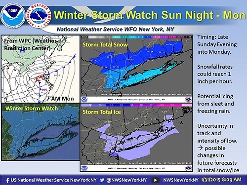
According to the National Weather Service, Long Island, New York City and New Jersey will all be getting hit with another round of snow during the evening of Sunday, February 1st into the afternoon of Monday, February 2nd.
As of Saturday morning, the storm is predicted to accrue approximately 5 – 10 inches of snow along with less than a tenth of an inch of ice. Hazards include large amounts of snow with a period of freezing rain and sleet.
Temperatures will be in the mid-20s to the mid-30s.
Northeast winds will reach 15 to 25 MPH with gusts up to 35 MPH.
Travel has the potential to be severely impacted by this storm with visibility only one quarter to one half mile at times. Snow, sleet and ice accumulations also have the potential to make traveling dangerous. Practice caution if you must be on the road during the predicted storm time of Sunday evening into Monday afternoon.
Although no School Closings or Delays have been announced yet, be sure to check our Long Island School Closures Page for the latest updates on your local district closings.
For the most up to date weather information, head over to the LongIsland.com Weather Center, where you can find the latest weather forecasts, advisories and more.
To get the latest traffic & road conditions before traveling, visit the LongIsland.com Traffic Center, and be sure to check out the live traffic feeds on our Traffic Cams Page.
[Sources: NWS]
Photo via the NWS's Official Facebook Page.


