Update - 8:05 PM - The Winter Weather Advisory for Long Island has been extended until 9 AM Tuesday morning. Be sure to check back regularly for the latest Winter Weather Updates.
Update - 4:30 PM - The Winter Weather Advisory for Long Island has been extended until 1 AM Tuesday morning.
The National Weather Service has issued a Flood Advisory for Long Island, Queens, and Brooklyn today due to this morning's the heavy rains and melting snow that can potentially create flooding - especially in areas with poor drainage. The Advisory will be in effect until 1 PM this evening. Drivers are advised to take extra caution during this time, and to avoid driving through areas where there is flooding. The NWS warns drivers to turn around if they encounter an roadway that is covered in water, stating that most flooding fatalities occur in automobiles.
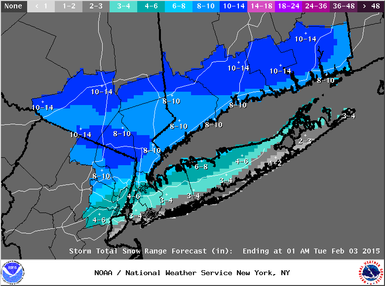
Also in effect for all of Nassau & Suffolk Counties is a Winter Weather Advisory and a Hazardous Weather Outlook, which will stay in effect until 6 PM this evening. The latest report from the NWS estimates that Long Island will get 3 to 5 inches of snow, and 1/4 to 1 inch of ice throughout the day. This morning's sleet and freezing rain is expected to turn into sleet and snow, and eventually taper into snow during the afternoon. Winds of 10 - 20 MPH, with gusts of up to 25 MPH can be expected throughout the day.
The NWS warns that untreated roadways will become icy before rush hour this evening, and advises drivers to take caution. To get the latest traffic & road conditions before traveling, visit the LongIsland.com Traffic Center, and be sure to check out the live traffic feeds on our Traffic Cams Page.
Numerous School Districts in both Nassau & Suffolk Counties have announced morning delays and class cancellations for today, and it is possible that districts will announce delays and closures for Tuesday as well. Be sure to check our Long Island School Closures Page for the latest updates on your local district closings.
For the most up to date weather information, head over to the LongIsland.com Weather Center, where you can find the latest weather forecasts, advisories and more.
[Sources: NWS.]