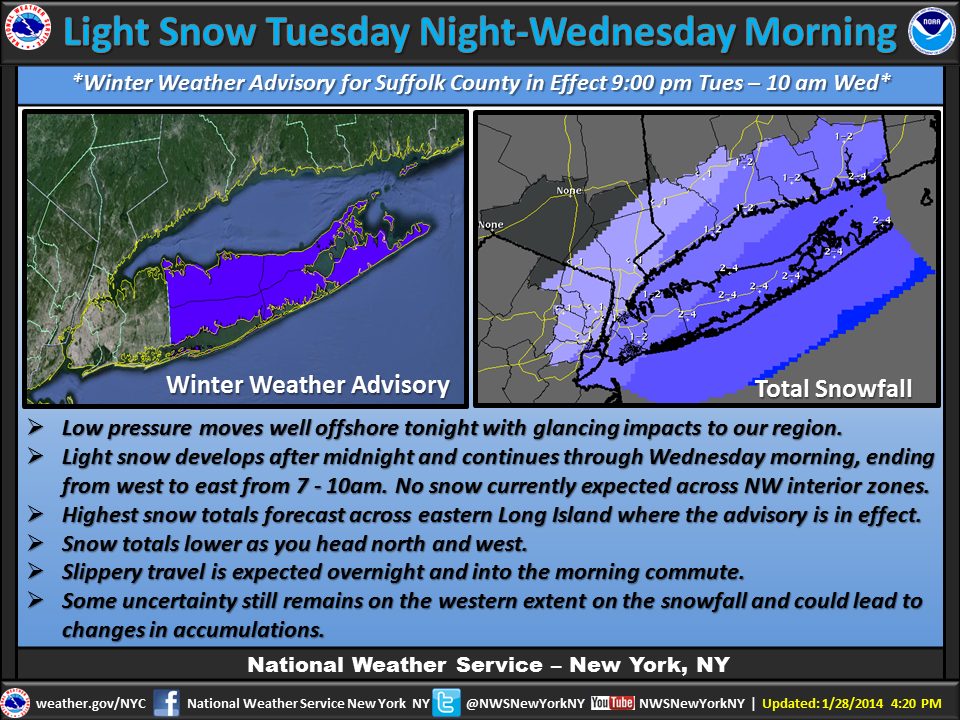
The National Weather Service has issued a Winter Weather Advisory and Hazardous Weather Outlook for Suffolk County, as a snow storm approaches the area. Both advisories will go into effect this evening at 9PM, and stay in effect until 10AM tomorrow morning.
Residents in Suffolk can expect to wake up to an additional 2 to 4 inches of snow, with the highest accumulation amounts predicted to be out east on the North and South Forks of the Island. Temperatures are expected to drop below freezing, and temps between 15-20 degrees (F) should be expected. Snow is expected to begin falling late this evening, and continue into early Wednesday morning. Winds of up 10-15MPH are predicted as well, with gusts of up to 20MPH a possibility.
The low temps, high winds, and additional snowfall have the potential to create dangerous driving conditions, including low visibility (of 1/2 a mile or less) and slippery roadways. Travelers are urged to take caution, and stay alert when on the roads. Before you get ready to hit the road, be sure to visit LongIsland.com's Traffic Camera Center, where you can view local road conditions in real time.
Although no delays or closings have been announced as of yet, you can get the latest updates on School Closures for Long Island right here.
For the most up to date weather information, visit the LongIsland.com Weather Center, where you can find the latest weather forecasts, advisories, and more.
[Source: National Weather Service.]
Photo via the National Weather Service's Official Facebook Page.