


October 3, 2012; Hicksville, NY -- The Nassau Suffolk Water Commissioners Association (NSWCA), comprised of commissioners from 21 Long Island water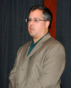 districts, recently welcomed Ron Busciolano of the U.S. Geological Survey (USGS) at its September meeting held at Crossroads Restaurant in Hicksville. Busciolano, a Hydrogeologic Supervisor, studies the distribution and movement of groundwater in the soil and rocks of the Earth’s crust. His presentation was part of the NSWCA’s Continuing Education Program.
The overall mission of the USGS is to contribute scientific data and strategies that address the impact of growing population on natural and critical resources. The data available to NSWCA Water Districts through the USGS is an important part of water management on Long Island. These efforts provide Water Commissioners and decision makers with scientific information to help minimize negative effects of an expanding society on water resources.
As Supervisor of Hydrogeology, Busciolano discussed the USGS’ annual synoptic survey. It includes data collected from over 600 well sites and 40 streams and lakes. Each site represents a snapshot of the hydrogeological landscape and helps the USGS create a water map of the area.
"Long Island has a particularly unique geological situation," Busciolano stated, "as virtually all the water comes from underlying aquifers. These aquifers are sometimes called upon to supply more than 400 million gallons of groundwater in any given day for public, domestic, industrial and irrigation uses."
Shifts in usage can change the flow of water, drawing it from new directions. "A negative result may include seawater intrusion and/or contamination of the deeper level aquifers," Busciolano continued. "Data on shifts in water movement and nitrate depths are imperative to the proper management of our water resources."
The USGS map provides a deep and clear understanding of water status. "Such mapping helps keep local water districts abreast of regional and local conditions and trends," said Robert McEvoy, President of NSWCA. "It is an excellent informational source and assists water districts in decision making."
The USGS is funded locally with matching Federal Government aid. The next survey is scheduled to begin October 1, 2012. The data gathered by the USGS is used by NSWCA and is also available to the public at http://ny.water.usgs.gov.
Busciolano’s presentation is another part of the NSWCA’s ongoing effort to utilize education to improve policies, procedures and decision making in the conservation and protection of Long Island’s water resources.
The NSWCA is comprised of Water Commissioners from 21 Nassau County and Suffolk County Water Districts. NSWCA is dedicated to communication, efficiency and best practices among Long Island’s water districts. As part of its mission, the association holds monthly educational meetings sponsoring experts on topics that include law, cost efficiencies, rules and regulations and issues germane to water utilities.
For more information on this development or for further information regarding your District’s Water Commissioners contact: Mr. Jamie Stanco, Progressive Marketing Group, Inc. at 631-756-7160, jpstanco@pmgstrategic.com
For more information on the Nassau Suffolk Water Commissioners Association contact: Mr. Robert McEvoy, President NSWCA at 516-322-3168.
# # #
